Carlingwood
Explore the residential neighbourhood around Carlingwood Shopping Centre, with local parks and a public library.
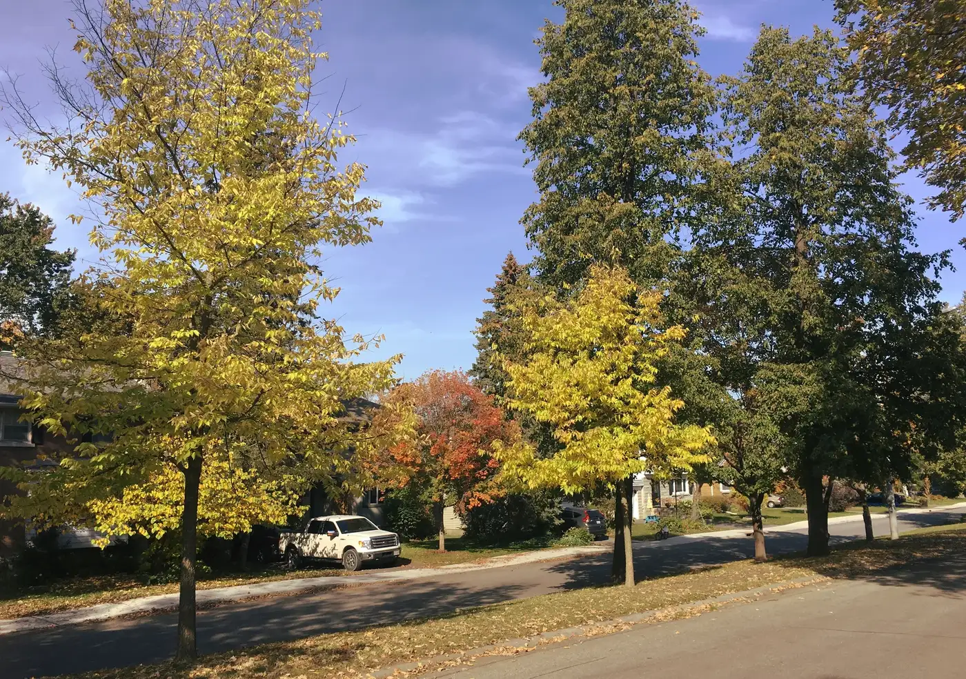
Carlingwood is a residential neighbourhood around Carlingwood Shopping Centre in Ottawa's west end, in Bay Ward. The community association area lies between Richmond Road, Sherbourne Road, Carling Avenue and Woodroffe Avenue. The shopping centre opened in 1956, with the surrounding neighbourhood developing later in that decade. Everyday destinations include Loblaws and Rexall at the shopping centre and the Carlingwood library branch at 281 Woodroffe Avenue. By car, downtown Ottawa (Parliament Hill) is about 9.9 km away, roughly 13 minutes in free-flowing traffic (OSRM estimate).
Updated · Facts on this page link to their sources
About Carlingwood
Carlingwood is a residential neighbourhood around Carlingwood Shopping Centre in Ottawa's west end, in Bay Ward. The community association area lies between Richmond Road, Sherbourne Road, Carling Avenue and Woodroffe Avenue. The shopping centre opened in 1956, with the surrounding neighbourhood developing later in that decade. Everyday destinations include Loblaws and Rexall at the shopping centre and the Carlingwood library branch at 281 Woodroffe Avenue.
Boundaries
This guide uses the Carlingwood Community Association area described by Olde Forge Community Resource Centre: Richmond Road to the north, Sherbourne Road to the east, Carling Avenue to the south and Woodroffe Avenue to the west. Definitions vary: All Things Home uses a larger Carlingwood area that also includes several surrounding neighbourhoods. oldeforge.ca openstreetmap.org
Homes
Carlingwood includes detached houses and apartment buildings. A 2021 planning rationale filed with the City describes detached dwellings in Carlingwood and medium- to high-rise apartments along Carling Avenue. The neighbourhood developed in the late 1950s; apartment additions included Saville Apartments in 1963 and Bromley Square in 1972. webcast.ottawa.ca
- Loblaws and Rexall at Carlingwood Shopping Centre.
- Carlingwood library at 281 Woodroffe Avenue.
- Seasonal wading pool at Woodroffe Park.
- Community events and a community rink.
- Early French Immersion at Woodroffe Avenue Public School.
- ServiceOntario in the shopping centre.
Community
How Carlingwood came to be
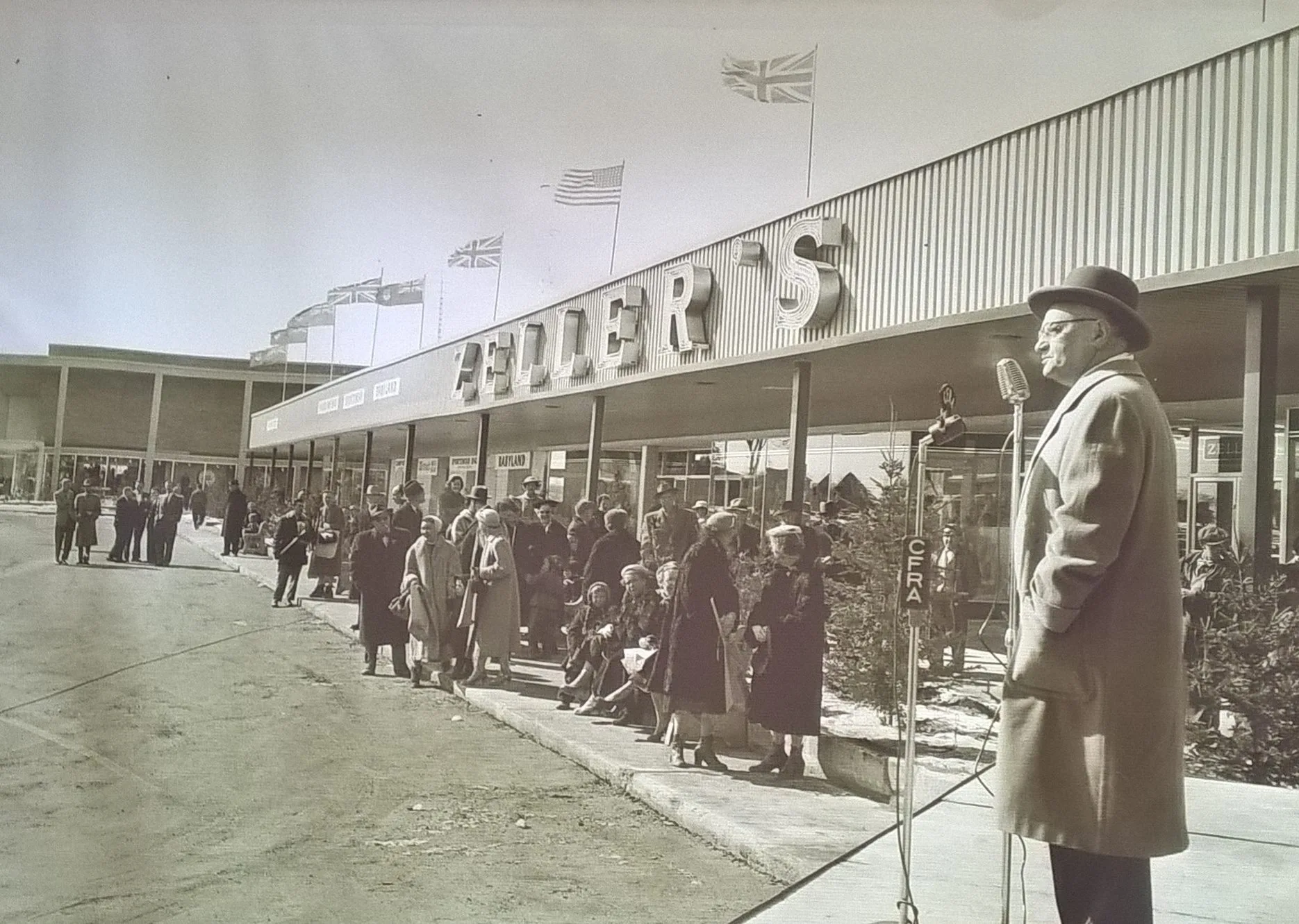
- Late 1950s
The residential neighbourhood around the shopping centre developed later in the 1950s. en.wikipedia.org
- 1956
Carlingwood Shopping Centre opened in Ottawa's west end. kitchissippi.com
- 1966
The purpose-built Carlingwood library opened to the public in August, followed by its official opening on October 13. kitchissippi.com
- 1986
The Carlingwood Community Association was formed, according to its past president's testimony to an Ontario legislative committee in 1994. ola.org
Around Carlingwood
Walking rings at 5, 10 and 15 minutes from the neighbourhood centre.
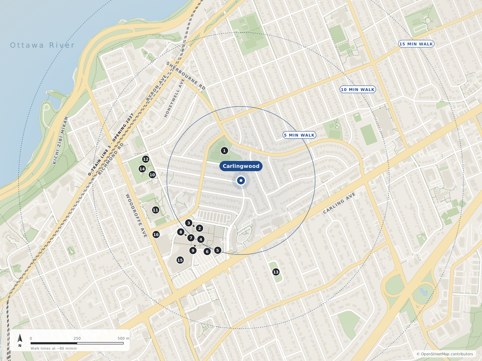
- 1Westwood Park190 m
- 2Coles350 m
- 3YMCA350 m
- 4Carlingwood Shopping Centre380 m
- 5Loblaws400 m
- 6World Echoes400 m
- 7Dollarama420 m
- 8Rexall420 m
- 9Mr. Pretzels430 m
- 10Wading Pool - Woodroffe480 m
- 11Woodroffe Avenue PS490 m
- 12Woodroffe Park Ice Rink530 m
- 13Glabar Park530 m
- 14Woodroffe Park540 m
- 15Canadian Tire540 m
- 16Ottawa Public Library - Carlingwood Branch540 m
Schools
8 nearbyWoodroffe Avenue Public School
OCDSBGrades JK–8235 Woodroffe Avenue, Ottawa, ONwoodroffeaveps.ocdsb.ca openstreetmap.org
490 m6 min walkOur Lady of Fatima School
OCSBGrades JK–62135 Knightsbridge Road, Ottawa, ONocsb.ca openstreetmap.org
610 m8 min walkNotre Dame High School
OCSBGrades 7–12710 Broadview Avenue, Ottawa, ONocsb.ca openstreetmap.org
780 m10 min walkBroadview Public School
OCDSBGrades JK–8535 Dovercourt Avenue, Ottawa, ONbroadviewps.ocdsb.ca openstreetmap.org
950 m12 min walkNepean High School
OCDSBGrades 9–12574 Broadview Avenue, Ottawa, ONnepeanhs.ocdsb.ca openstreetmap.org
1.0 km13 min walkEdelweiss Private Academy
31 Nadolny Sachs Privateopenstreetmap.org
1.1 km14 min walkOttawa Jewish Community School
31 Nadolny Sachs Privateopenstreetmap.org
1.1 km14 min walkD. Roy Kennedy Public School
OCDSBGrades JK–8919 Woodroffe Avenue, Ottawa, ONdroykennedyps.ocdsb.ca openstreetmap.org
1.2 km15 min walk
Straight-line distances from the Carlingwood centre. Living near a school does not guarantee a place: confirm the designated school for an address with each board. All schools and board locators.
Parks & places
10 nearbyWestwood Park
190 m2 min walkYMCA
350 m4 min walkWading Pool - Woodroffe
480 m6 min walkWoodroffe Park Ice Rink
530 m7 min walkGlabar Park
530 m7 min walkWoodroffe Park
540 m7 min walkOttawa Public Library - Carlingwood Branch
540 m7 min walkDavid Shentow Park
570 m7 min walkMcKellar Park Fieldhouse
790 m10 min walkMcKellar Park
800 m10 min walk
Shops & dining
10 nearbyColes
350 m4 min walkCarlingwood Shopping Centre
380 m5 min walkLoblaws
400 m5 min walkWorld Echoes
400 m5 min walkDollarama
420 m5 min walkRexall
420 m5 min walkMr. Pretzels
430 m5 min walkCanadian Tire
540 m7 min walkIan Murray Hearing Centre
620 m8 min walkCircle K
690 m9 min walk
Getting around
TransitSherbourne
700 m9 min walkOC Transpo route 84
710 m9 min walkOC Transpo route 51
800 m10 min walkNew Orchard
900 m11 min walkBus and O-Train to downtown
Route 51 serves Carlingwood and connects to Tunney's Pasture. Transfer there to eastbound O-Train Line 1 for Lyon, Parliament or Rideau. Check the current journey and detours before travelling.
Future O-Train service
OC Transpo lists Sherbourne as part of the future western extension and publishes 2027 for the Lines 1 and 3 West extension. This is planned service, not an operating station or a guaranteed opening date.
Driving
The City of Ottawa's mobility dashboard includes travel conditions between downtown and Carlingwood Mall at Woodroffe and Carling. Use current conditions rather than a fixed neighbourhood-wide drive time.
Walking and cycling
The NCC's Ottawa–Gatineau Cycling Map is a source for planning connections to the Capital Pathway. Most of the NCC pathway network is not cleared of snow in winter; check the relevant route and season.
For sale in Carlingwood
No Carlingwood homes on carlingwood.homes right now
Selling here? Get a website for your home, or browse every home for sale in the area.
Neighbouring areas
Quick answers
Short answers first; each links to the full answer and its sources.
Is Carlingwood a good place to live?
Carlingwood has grocery and pharmacy services at Carlingwood Shopping Centre and a public library on Woodroffe Avenue. Woodroffe Avenue Public School offers Early French Immersion, and Route 51 provides a bus connection to Tunney's Pasture.
As of 2026-10-30 · anthemproperties.com about.biblioottawalibrary.ca
Where is Carlingwood?
Carlingwood is in Ottawa's west end, in Bay Ward, around Carlingwood Shopping Centre. The core neighbourhood is roughly bounded by Richmond Road, Sherbourne Road, Carling Avenue and Woodroffe Avenue.
As of 2026-10-30 · en.wikipedia.org oldeforge.ca
What are homes like in Carlingwood?
Carlingwood includes detached houses and apartment buildings. A 2021 planning rationale filed with the City describes detached dwellings within Carlingwood and medium- to high-rise apartments along Carling Avenue.
As of 2026-10-30 · webcast.ottawa.ca
Why do different guides show different Carlingwood boundaries?
The community association area is bounded by Richmond Road, Woodroffe Avenue, Carling Avenue and Sherbourne Road. All Things Home uses a larger area that includes Glabar Park, Whitehaven, Woodpark, McKellar Park and Highland Park, so its broader description is not interchangeable with this guide's core area.
As of 2026-10-30 · oldeforge.ca allthingshome.ca
What municipal ward is Carlingwood in?
Carlingwood is in Bay Ward, numbered Ward 7 by the City of Ottawa. The City's ward maps are the source to consult for the municipal ward of a specific address.
As of 2026-10-30 · en.wikipedia.org ottawa.ca
How many people live in Carlingwood?
Wikipedia's Ottawa neighbourhood census table reports 3,622 people in 2021 for Carlingwood, using census tract 5050032.01. This is a dated census-tract figure, not a current population estimate or a total for every area marketed as Carlingwood.
As of 2026-10-30 · en.wikipedia.org